Montana
- 6,000 feet
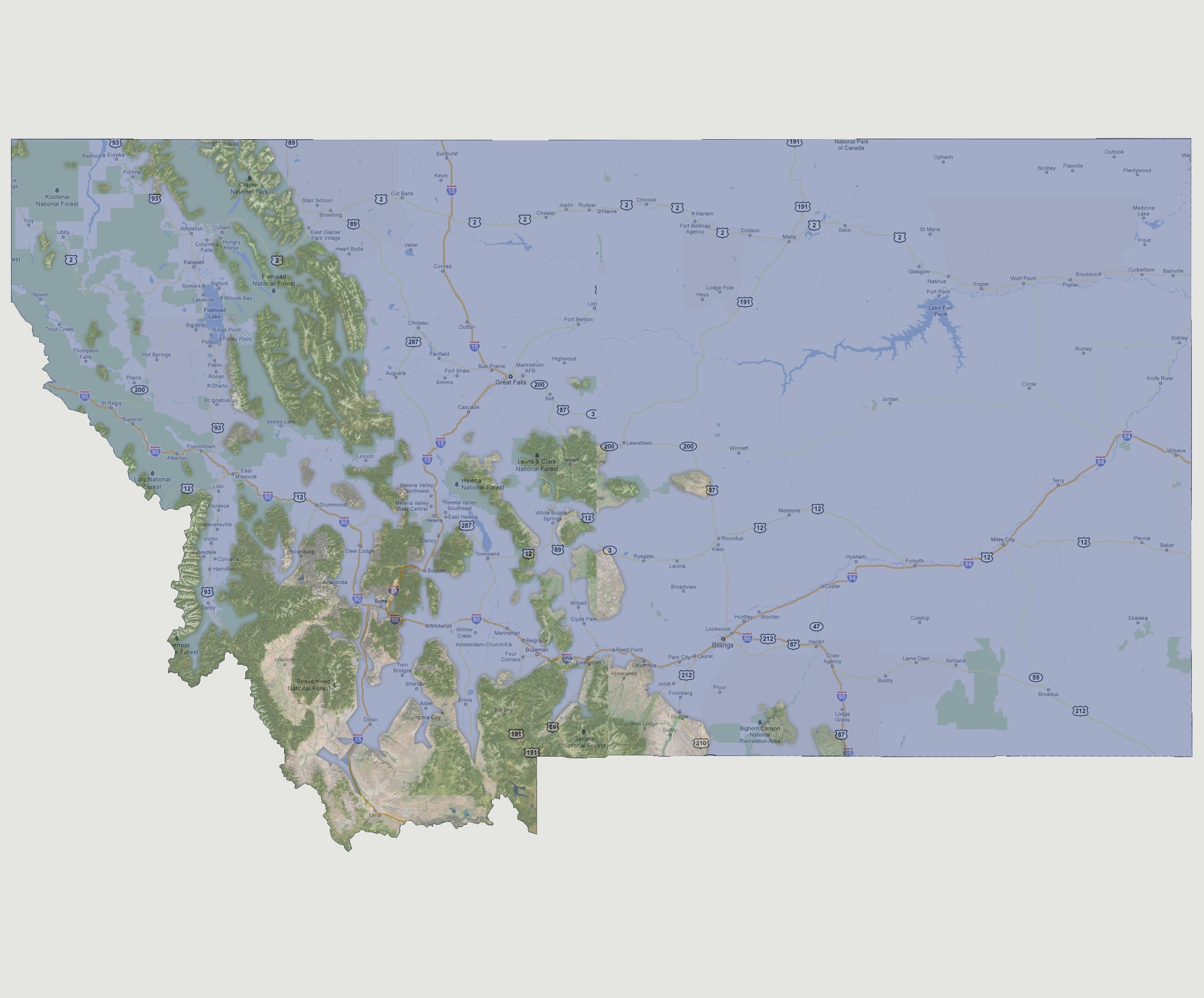
All
of Montana’s major roadways are now underwater. There are a number
of dislocated islands that make up the state from the Glacier National
Park at the northern border through Flathead and down to Gallatin National
Forest. The Beaverhead National Forest is also above water. There are
a few towns not inundated including Phillipsburg, Anaconda, Sin Sky, Absarokee
and Red Lodge.
© 2012