Texas
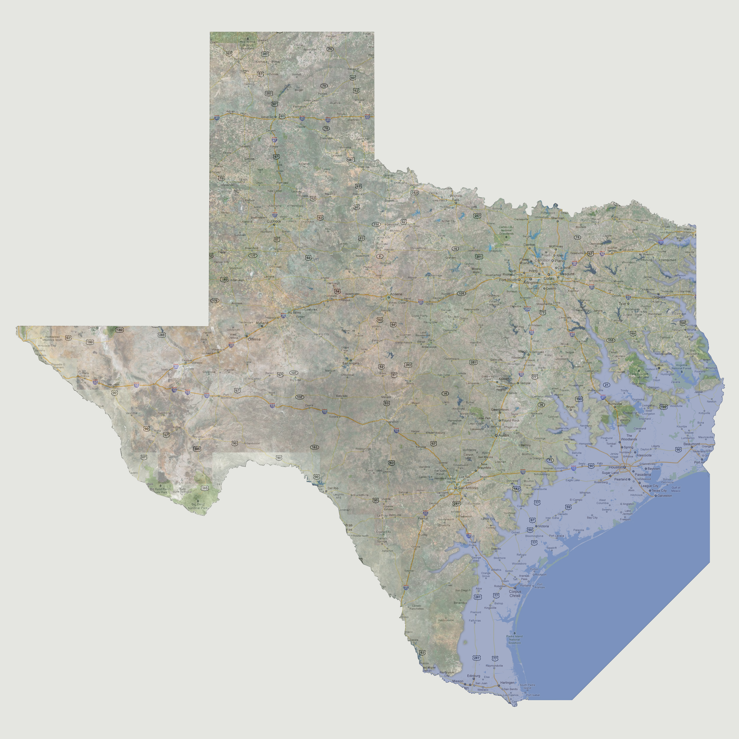
- 300 feet
Farther
coastal flooding from the Gulf would be the impact. This would reach inland
covering route 281 to the south, almost to San Antonio along Interstate
37 and in the northern Gulf coast, rivers would reach inland to Bryan,
Gun Barrel City, Lufkin, Longview, Mount Pleasant and Maud/Interstate
30 area. The Rio Grande River would also be breaking its banks at its
inlet to the Gulf.
© 2012