New
York - 600 feet
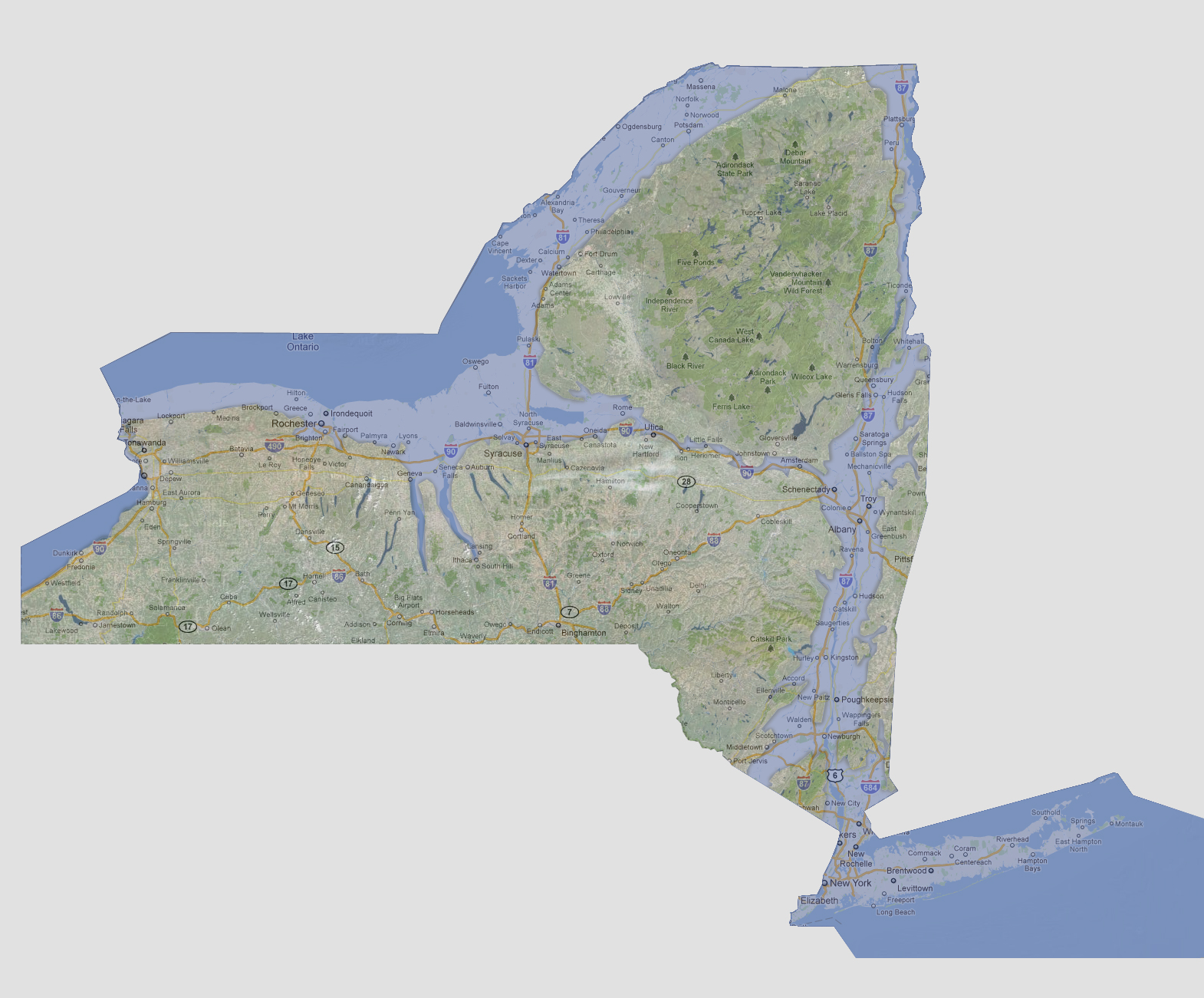
At
600 feet of sea level rise, Lake Ontario would be flooded by the Atlantic
Ocean through the Hudson River cutting straight through from Schenectady
to Utica following Interstate 90, flooding both towns. Most of Interstate
81 and 90 near Lake Ontario are underwater including Rochester. The Hudson
River’s banks would widen further from Troy south. The two largest
of New York’s Finger Lakes; Seneca and Cayuga Lakes, would now be
inlets of Lake Ontario. The Niagara Falls would cease to exist since Lake
Erie is at 571 feet above sea level meaning this is the point at which
Lake Ontario and Erie start becoming one large lake.
© 2012