New
Mexico - 6,000 feet
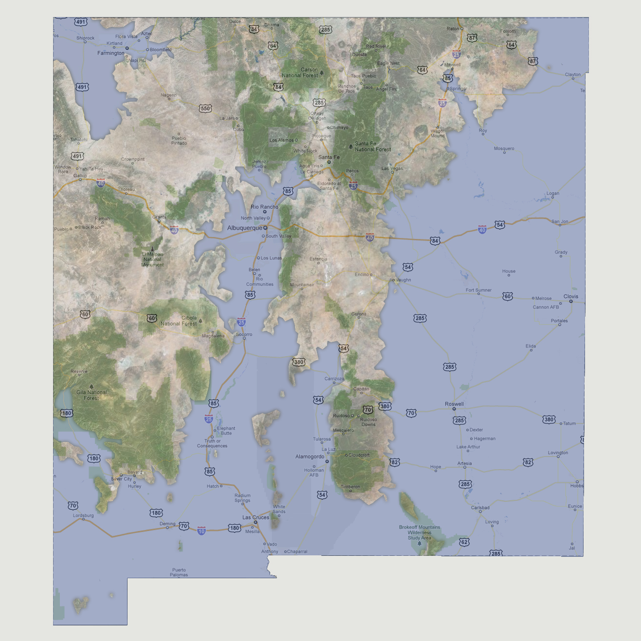
The
Rio Grande has cut a wide swath up through the center of New Mexico following
Interstate 25 north almost to capital Santa Fe, flooding the cities of
Rio Rancho and Albuquerque. The Rio Grande and Pecos Rivers have converged
just south of the Lincoln National Forest creating a peninsula that runs
north to Santa Fe. To the southwest, the Rio Grande has flooded along
interstate 10 to the western border and north as far as the Gila National
Forest area.
© 2012