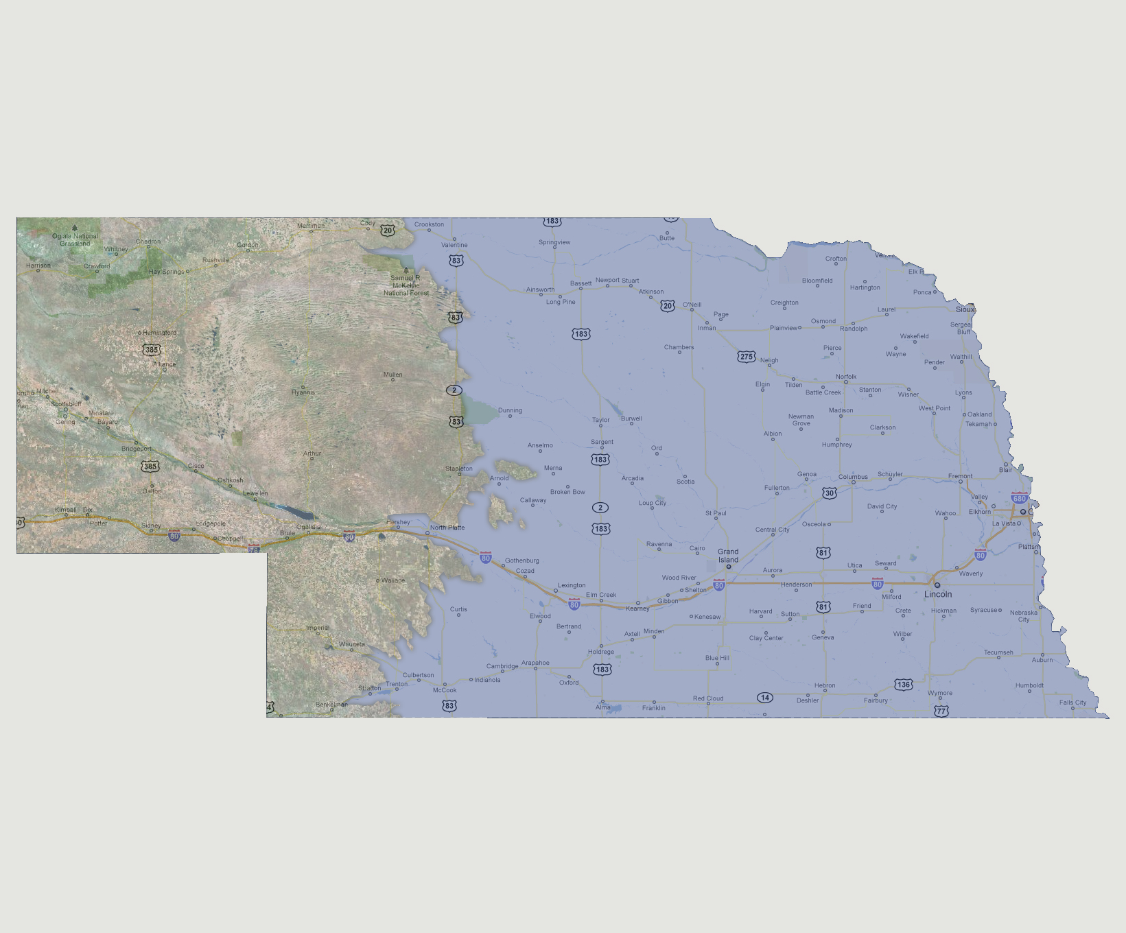

Nebraska
- 3,000 feet
As
the water levels rise to 3000 feet above sea level, the shoreline moves
farther west to Route 83. The Grand Island and Hastings are now underwater.
The Samuel McKelvie National Forest is half underwater due to the Niobrara
River flooding.
© 2012