Arizona
- 7,500 feet
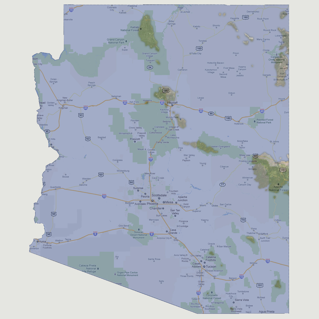
Arizona
is now made up of a number of islands. The largest is 600 square mile
island covering some of the Apache National Forest. Others include an
area of the Grand Canyon National Park, a small area just north of Flagstaff,
some surrounding the Canyon De Chelly National Monument and a few in the
Coronado National Forest.
© 2012